Kananaskis Observation Sites
About Kananaskis Country
The explorer John Palliser may have named the area after Kin-e-ah-kis, a native who had survived a skirmish near where the Kananaskis River flows into the Bow. His name can be translated from the Cree as “One who is grateful”. However, many think Kananaskis means “Meeting of the waters”.
Kananaskis Country is preserved by the Alberta Government, and is primarily an un-spoild wilderness area covering over 4000 square km (1440 sq. miles).
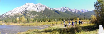
Our observation sites in Kananaskis Country are located in valleys, and all are within easy and short walking distances of good parking with very good road access. Our main site is the Hay Meadow, Mt. Lorette Site. Under some conditions we watch from subsidiary sites. These are Hostel Hill, Lusk Creek and Barrier Lake.
The Hay Meadow, Mt. Lorette Site
This site is on the bank of the Kananaskis River in a broad open valley which allows excellent, though rather distant viewing of the Fisher Range to the east. The bulk of the Golden Eagles and other raptors use this ridge as part of their preferred migration route.
Northwest end of Fisher Range // Southeast end of Fisher Range
Mt. Patrick // Mt. McDougal from Hay Meadow Site – October
CR Cliff Hansen
Naming the various features along the ridge helps us to communicate to each other where eagles are. The peak at the extreme right is Mt. McDougal (2700 m, 8859 ft) about 7.5 km away. We call the nearest mountain “Mt. Patrick”, but it has no official name. The big dip at the top of this mountain we call “The Smile” and the little dip to its left “The Little Smile”. Patrick was a young visitor from England who happened to have a magnificent smile. The continuous ridge is broken to the left of “Mt. Patrick” where the Kananaskis River flows through. The ridge resumes in Mt Lorette to the northwest- see photo below. To gain height for passage between “Patrick” and Lorette, eagles frequently soar over these peaks.

Mt. Lorette from Hay Meadow site. Lower slopes of Mt. “Patrick” in shadow to the right.
The lower slope of Mt. “Patrick” is seen on the right with the distant hump of Old Baldy above the trees to the right of the Kananaskis River valley. The mountain immediately left of the valley doesn’t have an official name but we call it “The Slab”. The prominent peak to the left is Mt. Lorette. It is almost due north of the observation site. During fall migration Golden Eagles and other raptors appear over Lorette and tend to soar there to gain height for the crossing of the river valley where fewer buoyant up-drafts exist. They often arrive at Patrick rather low and must soar again. Actually the soaring is of great importance since as the birds turn they tend to show identification features. For example they may show the upper surface of their tails while soaring, and a snow white tail base identifies a first year Golden Eagle. In the spring of course the flow is reversed with the Golden Eagles appearing over McDougal, flying the Fisher Range and soaring at “Patrick” for the crossing to Lorette. Our life would be simple if they all followed this plan. Most do, but Golden Eagles may be seen as little fast moving dots anywhere in the sky. We welcome help!
We find it very necessary to have names for easily recognized features along the sky line.
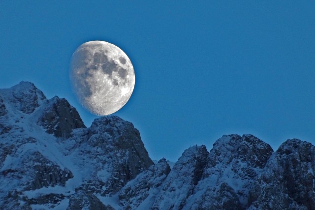
Moon rise over the “Bumps”, Fisher Range.
CR Cliff Hansen
If someone says “There’s one over the Bumps” we all know where to look.
To the west, the open area known as Hay Meadow, allows excellent viewing of Mt. Kidd, Mt. Allan, Mt. Columbola and Hummingbird Plume (We cannot find the origin of that lovely name. – Does anyone know?). Migrating raptors often use these peaks for their route.
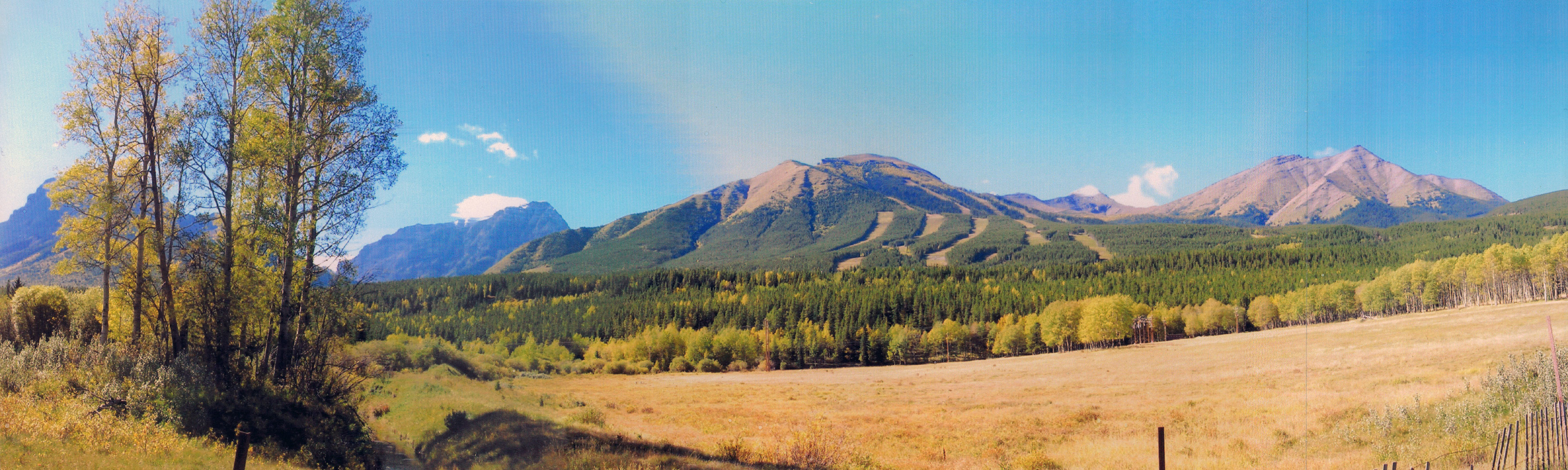
West facing panorama.
Hidden by the aspens on the left is Mt. Kidd (2958 m), blue in the distance Mt. Bogart (3185m – 10500 feet), the lower slopes of Mt. Allan with the ski slopes of Nakiska occupy the centre of the view, the peak of Mt. Allan (2819m), here looking very small, is just to the left of the small cloud which is sitting above the saddle joining Allan to Mt. Columbola on the right. At the extreme right the land is sweeping up to form the low forested ridge of Hummingbird Plume.
The meadow is very beautiful and attracts a variety of grazing wildlife and those that prey on them. Actually the whole area abounds in wildlife and sightings of White-tailed Deer, Mule Deer, Elk, Moose, Bighorn Sheep, Mountain Goat and Coyote are common. Less frequent are Black Bear, Grizzly Bear, Wolf and Lynx. We frequently see tracks of Cougar (Mountain Lion) in the snow, but this animal is very secretive and illusive.

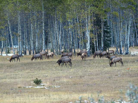 Don’t you dare get closer.
CR Cliff Hansen
Finding the Hay Meadow, Mount Lorette Site
Turn south from the Trans Canada Highway # 1 onto Highway # 40 and after about 25 km turn right at the sign for Kananaskis Village and the Nakiska Ski Resort. Drive west 1 km. Pass the turn for Kananaskis Village on your left and almost immediately turn right unto a gravel road signposted Stoney Trailhead. You will find a good parking area just a few hundred meters down this road. Leave your vehicle there.
The UTM coordinates Northing: 5645240, Easting 630842, Zone 11U. The GPS coordinates are DMM:50 56.635 N, 115 8.252 W.
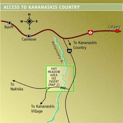
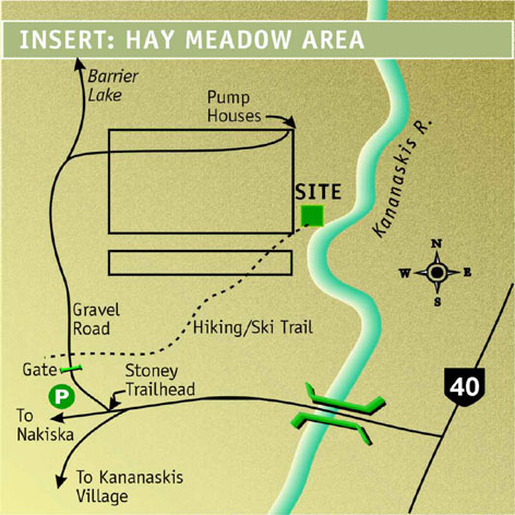 Maps not to scale
There are two ways to the site. You can follow the gravel road to the north and just after it straightens out after swinging west to avoid a wet area, fork right. The road crosses Hay Meadow to two wooden huts (pump houses) beside the Kananaskis River. The viewing area is a short distance south of these huts. For a prettier, slightly shorter route you can turn right just north of the parking area onto the well maintained Hiking/Ski trail and follow it until you reach the site. The walk to the site is about 1km and involves no elevation rise.
There are no facilities at the site!
Observation Disclaimer
The Rocky Mountain Eagle Research Foundation (RMERF ) will not accept any responsibility for injury or loss sustained by participants (for any perceived reason including negligence) in any field activities or other functions organized by or for RMERF
On occasion we have been forced by heavy snow or closure of the Hay Meadow trail to use a site closer to the parking area. This site also gives excellent viewing of the Fisher Range, Mt. Lorette and Hummingbird Plume but much of the west is obscured by trees. We call this The Hostel Hill Site. Instead of turning right onto the gravel Stoney Trailhead road continue west towards Nakiska about 300 meters and Hostel Hill is the open knoll on your left. You can park beside the road. The Hostel Hill Site has one big advantage- toilet facilities at nearby Ribbon Creek Picnic and parking area. It is also within a few hundred meters of very good accommodation at the International Hostel.
Unfortunately, to the east of the Fisher Range are two parallel mountain ridges and beyond them further parallel foothill ridges. We know that weather often forces eagles to abandon their preferred route along Fisher and fly a parallel route.
One fall two separate but complete counts were made, one at Hay Meadow and one near Barrier Lake in the next valley to the east. Careful recording of times and routes enabled us to work out that a quarter of the total Golden Eagles recorded during that migration were not seen from Hay Meadow. The Barrier Lake site is seldom used but we hope to employ it again in the future when we have enough trained observers to cover both sites at the same times.
On occasional days when the mountain ridges are obscured the Principal Observer will decide to move to the little used Lusk Creek Site. This site offers fairly open views of the easternmost mountain ridge and the first of the foothill ridges. The site lies about one kilometre east on a secondary road (signed to Calgary) which branches off Highway 40 a short distance north of Barrier Lake.
All of the Hay Meadow, Barrier Lake and Lusk Creek sites are kept in mind for future complete recording of Golden Eagle migration when sufficient man power is available.
All the Principal Observers and most of the assistants are well versed in bird recognition.
Study of the Golden Eagle migration has brought many thousands of hours of bird expert time to this spot. Within 2 or 3 kilometres of Hay Meadow 236 bird species have been recorded. Scanning for raptors high above the peaks has revealed many other (sometimes unexpected) migrating species. Other birds recorded are beyond their previously known occurrence range. Peter Sherrington deserves special mention for his work in all seasons of many years and in the compilation of extensive information on the birds in the area around Hay Meadow.
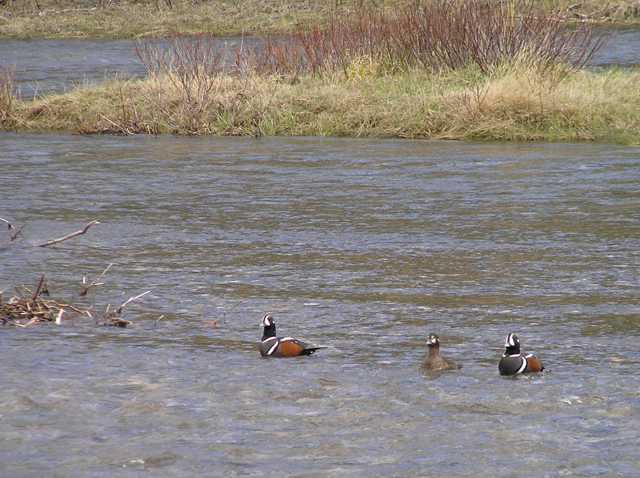
Harlequin Duck breed on the Kananaskis River and frequently visit us.
CR Cliff Hansen
A checklist of the birds in Kananaskis Country may be found by accessing the link below.
Kananaskis Birds Checklist. (PDF)
If you are a visitor to Kananaskis you will probably be interested in where you can find suitable accommodation and other exciting places to visit.
Visitor Information and Attractions for Kananaskis area.
On good viewing days during peak migration, visitors to Hay Meadow will find our observers present. You are very welcome to join them. If you need further information please Contact us.